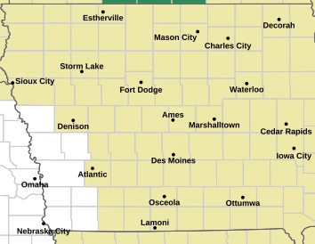
The National Weather Service in Des Moines is urging Iowans to stay weather-aware today as periods of heavy rainfall could lead to localized flash flooding, especially in urban and low-lying areas.
Forecasters say the greatest concern is heavy downpours that may overwhelm drainage systems, causing water to collect on streets and in flood-prone locations. Drivers are reminded to never attempt to cross flooded roadways.


In addition to the flooding threat, isolated severe thunderstorms are possible this afternoon across portions of central and eastern Iowa. Some storms could produce damaging winds, large hail, and frequent lightning.
Residents are encouraged to monitor the latest forecasts throughout the day and be prepared to take shelter if severe weather develops. Conditions can change quickly, so having multiple ways to receive weather alerts is recommended.
For the latest National Weather Service weather briefing, visit the Des Moines NWS briefing packet.
Additional severe weather information is available at the NWS severe weather page, while flood and river information can be found at the NWS hydrology page.
Source: National Weather Service – Des Moines.