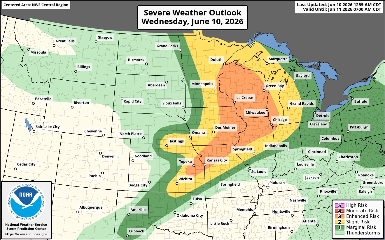
The National Weather Service in Des Moines has issued an updated weather briefing warning Iowans to prepare for multiple rounds of severe thunderstorms and heavy rainfall through Thursday afternoon.
According to forecasters, the greatest risk for severe weather and heavy rain will be across eastern and southern Iowa, although much of the state could see impacts. Meteorologists say several rounds of storms are expected, increasing the potential for localized flooding, damaging winds, large hail, and other severe weather hazards.


Storm chances began Wednesday morning and are expected to continue through Thursday. The most favorable window for severe weather on Wednesday is between 3 p.m. and 11 p.m. Additional rounds of storms are expected Thursday, with the highest threat occurring between 4 a.m. and 5 p.m. Forecasters note there may be a brief lull in activity late Thursday morning into early afternoon before another round develops.
Emergency management officials encourage residents to closely monitor weather forecasts and have multiple ways to receive warnings, especially during overnight hours when storms may develop while people are sleeping.
The National Weather Service has made the latest weather briefing available online and continues to provide updated severe weather and flood information as conditions evolve. Residents are urged to stay weather aware and be prepared to take action if warnings are issued for their area.