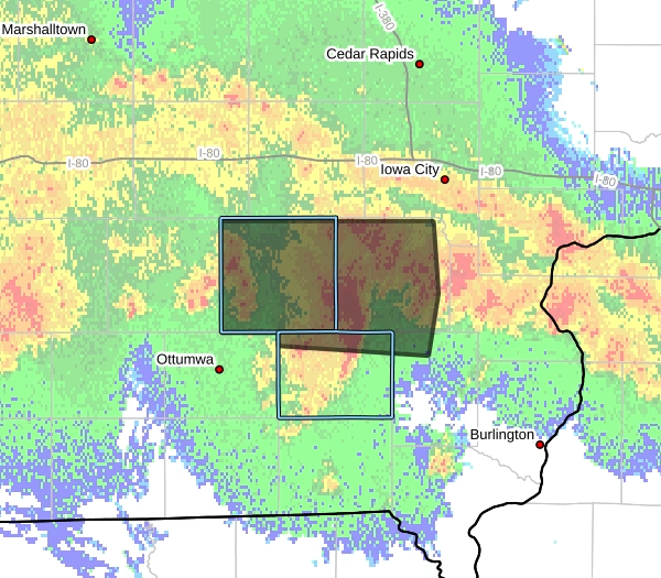
The National Weather Service in Des Moines is warning Iowans to remain alert for several rounds of thunderstorms that could bring heavy rainfall, localized flooding and severe weather.
Storms are expected across much of Iowa from this morning into tonight, with another round possible Saturday afternoon and Saturday night. Some storms could produce locally significant flooding or become severe.


A Flood Watch remains in effect through Saturday morning for much of central Iowa. Forecasters say repeated rounds of rain could cause water to quickly accumulate, especially in areas that have already received significant rainfall this week.
Rainfall rates could reach 1 to 2 inches per hour in the heaviest storms. That could lead to flooding along rivers, creeks and streams, as well as in low-lying, poor-drainage and urban areas.
Residents should monitor updated forecasts and be prepared to take action if Flash Flood Warnings are issued. Never drive through a flooded roadway, as water depth and current can be difficult to judge.
The Flood Watch is currently scheduled to expire at 10 a.m. Saturday.
The National Weather Service encourages residents to stay weather-aware throughout the weekend as additional storms are possible.
Source: National Weather Service, Des Moines