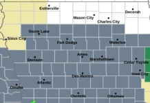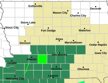
The National Weather Service in Des Moines is warning Iowans to stay weather aware as rounds of thunderstorms and heavy rainfall are expected to continue through much of the week and into the weekend.
According to the latest weather briefing from the Des Moines National Weather Service, repeated rounds of rain could create concerns for flash flooding and river flooding, especially as additional rainfall moves across areas that have already received rain.


The greatest focus for thunderstorms and heavy rainfall today through Thursday will be across central and southern Iowa, with a more widespread threat developing Friday into Saturday.
Severe weather is expected to become a greater concern Friday afternoon and evening. The National Weather Service says all severe weather hazards are possible, meaning residents should be prepared for changing conditions and continue monitoring updated forecasts.
The active weather pattern is expected to continue through much of the week. The National Weather Service notes that repeated heavy rainfall could increase the potential for flooding as soils become increasingly saturated and water moves into area waterways.
Residents are encouraged to keep an eye on the forecast, have multiple ways to receive weather alerts and never drive through flooded roadways.
The National Weather Service Des Moines weather briefing is available at weather.gov/dmx.
Additional severe weather information is available through the National Weather Service’s severe weather decision support page.
Source: National Weather Service — Des Moines, Iowa.