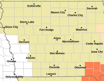
The National Weather Service in Des Moines is warning Iowans to stay weather-aware as several rounds of thunderstorms could move across the state beginning early Tuesday and continuing through at least Wednesday.
The first and highest threat is expected Tuesday morning between 3 and 10 a.m., especially across northern Iowa. Damaging wind gusts are the main concern, although isolated large hail and locally heavy rainfall are also possible.


The threat doesn’t end Tuesday morning. Additional chances for strong to severe thunderstorms are expected across parts of central Iowa Tuesday night, followed by another potential round Wednesday afternoon into the evening.
Forecasters note that the exact timing and location of later storms will depend, in part, on what happens with the earlier rounds of thunderstorms.
Residents are encouraged to keep an eye on changing weather conditions, especially if traveling or spending time outdoors. Those with outdoor plans should have multiple ways to receive weather warnings.
The latest briefing from the National Weather Service in Des Moines is available through the agency’s website. NWS Des Moines Weather Briefing
Additional information on severe storms is available from NWS Des Moines Severe Weather Information, while NWS Des Moines Hydrology Information provides updates concerning rainfall and flooding concerns.