


The National Weather Service office in Des Moines is warning that strong to severe thunderstorms could impact much of Iowa late Friday afternoon and evening.
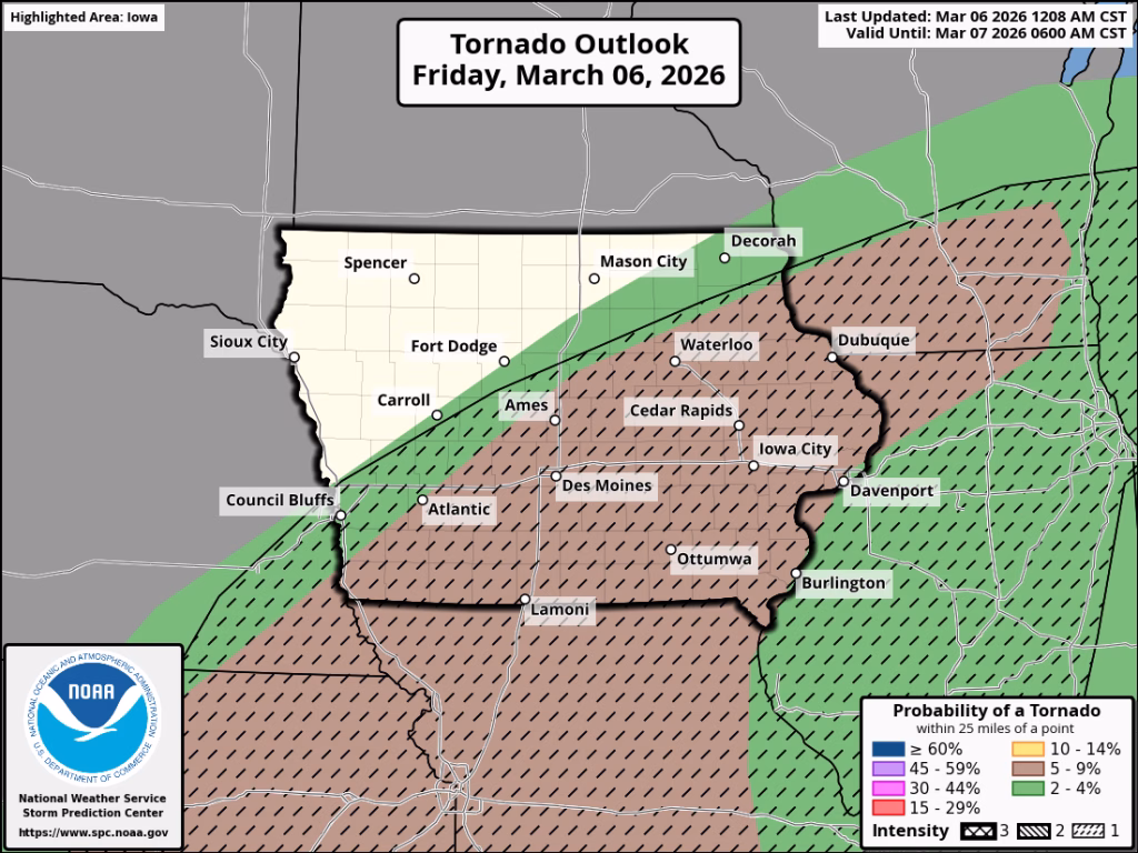
Forecasters say the state is under up to an Enhanced Risk (Level 3 of 5) for severe weather, with the highest risk in southwestern Iowa. Storms are expected to begin developing late in the afternoon, potentially moving into parts of the area as early as 4 p.m., with the most likely arrival around 5 p.m.


Meteorologists say the storms could bring large hail, damaging wind gusts, and a few tornadoes. Wind gusts may exceed 60 mph across much of the state, while some stronger storms could produce gusts up to 75 mph. Hail larger than one inch in diameter (about the size of a quarter) is possible, and in the strongest storms hail could reach two inches, roughly golf-ball size.
There is also the potential for a few tornadoes, mainly across central and southern Iowa, with some areas capable of seeing tornadoes as strong as EF-2.
Showers and thunderstorms may occur during the morning hours, but the main severe weather threat is expected from late afternoon into the evening. Storms should move out of most of the state around midnight, though they could linger until about 3 a.m. in southeastern Iowa.
In addition to the severe weather threat, forecasters say northwestern Iowa could see rain transition to a wintry mix or freezing rain late tonight into early Saturday as temperatures drop.
Officials encourage residents to stay weather aware, monitor updated forecasts, and be prepared to take shelter if warnings are issued. The next weather briefing from the National Weather Service is expected by 4 p.m. Friday.
More severe weather information and updates are available from the National Weather Service office in Des Moines.
https://www.weather.gov/dmx/dsssevere


